HISTORIC MARITIME ATLAS · PORTS & GLOBAL TRADE
The Coastlines That Built Great Trading Cities
Discover how sheltered bays, navigable waterways, and favorable coastal geography helped small settlements become major centers of maritime commerce.
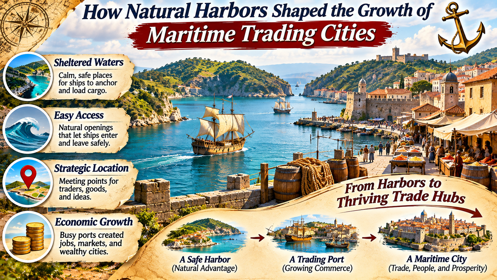
Throughout history, some of the world’s most influential cities developed beside sheltered stretches of coastline.
These locations offered ships protection from dangerous weather, access to navigable waters, and convenient places to exchange goods.
Long before modern container terminals and artificial breakwaters, natural harbors provided important advantages for maritime trade.
A protected bay could attract fishing communities, merchants, shipbuilders, and travelers.
As trade expanded, the surrounding settlement might develop warehouses, markets, roads, financial institutions, and administrative centers.
Over generations, these activities could transform a small coastal community into a major commercial city.
Natural harbors did not guarantee urban prosperity, but they often provided the geographic foundation upon which successful maritime trading cities developed.
What Makes a Natural Harbor Valuable?
A natural harbor is a coastal location where geographic features provide some protection for vessels.
Bays, inlets, estuaries, islands, and headlands can reduce exposure to waves and strong winds.
However, shelter alone does not make a harbor suitable for major commercial activity.
Ships also need sufficient water depth, navigable approaches, and practical access to shore.
A harbor with deep water may accommodate larger vessels, while a shallow estuary may require smaller ships or careful navigation.
Tidal conditions, currents, sediment movement, and the availability of freshwater can also influence harbor development.
The surrounding landscape matters as well.
A sheltered anchorage connected to productive agricultural regions or inland transportation routes may offer greater commercial opportunities than an isolated bay.
NAUTICAL GEOGRAPHY / HARBOR CONDITIONS
Protection from waves and storms.
Enough water for vessels to enter and anchor.
Suitable locations for unloading cargo and reaching shore.
Routes linking the harbor with producers and markets.
Why Protected Anchorages Mattered to Early Sailors
Before the development of powerful modern engines and advanced navigation systems, maritime travel depended heavily on wind, weather, and coastal geography.
Sailing vessels could be vulnerable to strong storms, rough seas, and unpredictable coastal conditions.
Protected anchorages offered places to wait for favorable weather, repair equipment, and obtain supplies.
They also made loading and unloading cargo safer and more practical.
In many regions, ships traveled along established coastal routes and stopped at suitable harbors.
These stopping points became locations where merchants exchanged goods and information.
As maritime activity increased, permanent settlements often developed nearby.
Harbors therefore served as more than physical shelters.
They became meeting places connecting different communities and commercial networks.
How Maritime Trade Encouraged Urban Growth
A busy harbor could create economic opportunities far beyond the activities taking place aboard ships.
Merchants needed storage facilities for imported and exported goods.
Shipowners required skilled workers to maintain vessels.
Travelers and crews needed food, accommodation, and supplies.
Governments established customs systems and other institutions to regulate commerce and collect revenue.
Over time, these activities encouraged the development of specialized urban districts.
Markets, workshops, warehouses, and administrative buildings became concentrated near the waterfront.
Roads and other transportation connections expanded to move cargo between the port and surrounding regions.
As trade increased, the settlement could attract additional workers, entrepreneurs, and residents.
This process helped transform some harbor communities into major trading cities.
The Importance of Rivers and Inland Trade Routes
Many successful maritime cities developed where coastal shipping routes connected with navigable rivers.
Rivers could transport agricultural products, timber, minerals, and manufactured goods from inland regions to the coast.
They also allowed imported products to move toward interior markets.
This connection increased the economic importance of the harbor.
A port serving a large inland region could attract more commercial activity than one with limited access beyond its immediate coastline.
However, river mouths also presented challenges.
Sediment accumulation could create sandbars and reduce navigable depth.
Changing river channels and tidal conditions sometimes required expensive harbor improvements.
The most successful ports often combined favorable natural geography with investments in transportation infrastructure.
Historic Examples of Harbor Cities
Several important maritime cities illustrate how coastal geography influenced commercial development.
Each city followed a different historical path, shaped by politics, technology, and changing trade networks.
New York: A Harbor Connected to a Vast Hinterland
New York developed around an extensive natural harbor and a network of waterways.
Its coastal location provided access to Atlantic shipping routes.
The Hudson River connected the port with inland regions.
The opening of the Erie Canal in 1825 further strengthened connections between New York and the Great Lakes region.
These transportation advantages helped expand the city’s commercial influence.
However, its growth also depended on immigration, finance, industrial development, public investment, and changing economic conditions.
Hong Kong: Deep Water and Strategic Location
Hong Kong’s sheltered waters and deep-water harbor helped support its development as an international trading center.
Victoria Harbour offered a valuable location for maritime activity along important regional shipping routes.
Over time, commercial infrastructure, shipping services, financial institutions, and industrial development contributed to the city’s growth.
Its historical role was also shaped by colonial administration and its relationship with mainland China.
Natural harbor geography provided an advantage, but political and economic developments were equally significant.
Singapore: A Trading Center at a Maritime Crossroads
Singapore occupies a strategic position near major shipping routes connecting the Indian Ocean and the South China Sea.
Its sheltered coastal waters supported maritime activity, while its location made it attractive for regional trade.
The establishment and expansion of port facilities helped transform Singapore into a major commercial center.
Its development depended on far more than natural geography.
Trade policies, infrastructure, shipping services, and industrial planning also played important roles.
Istanbul: A City Between Two Seas
Istanbul developed at a strategic location connecting the Black Sea and the Mediterranean through the Bosporus and associated waterways.
The Golden Horn provided a sheltered natural harbor that supported maritime activity for centuries.
The city’s position contributed to its importance as a political, military, and commercial center.
Control over surrounding waterways influenced trade and transportation between different regions.
Istanbul demonstrates how harbor geography could reinforce the importance of an already significant urban center.
HISTORICAL GEOGRAPHY / KEY OBSERVATION
A Good Harbor Attracted Ships. Strong Connections to Trade Networks Helped Build a City.
The most influential maritime centers combined coastal advantages with infrastructure, institutions, and access to regional or international markets.
How Harbors Encouraged Cultural Exchange
Maritime trading cities were important centers of cultural interaction.
Ships carried people, languages, technologies, ideas, and religious traditions alongside commercial goods.
Merchants from different regions often established communities near major ports.
These interactions influenced architecture, food, language, and urban customs.
Harbor cities could become culturally diverse because they maintained connections with distant societies.
However, maritime exchange was not always peaceful or equitable.
Some trading networks were associated with conquest, forced labor, slavery, and colonial exploitation.
Understanding port-city history therefore requires examining both commercial opportunity and the unequal power relationships that shaped global trade.
The Development of Waterfront Infrastructure
As maritime commerce expanded, natural harbors were often modified to accommodate more ships and larger cargo volumes.
Wharves and docks provided places for vessels to load and unload.
Warehouses allowed merchants to store goods before distribution.
Shipyards supported vessel construction and repair.
Lighthouses, navigation markers, and harbor regulations helped improve safety.
Some ports required dredging to maintain sufficient water depth.
Others constructed breakwaters or expanded docking facilities.
These improvements demonstrate how cities transformed natural geographic advantages into organized commercial infrastructure.
Why Some Natural Harbors Became More Successful Than Others
Not every sheltered harbor developed into a major trading city.
Commercial success depended on several additional factors.
A harbor needed connections to goods, producers, and consumers.
Political stability and reliable commercial institutions could encourage merchants to conduct business.
Security mattered because piracy, warfare, and conflict could disrupt maritime routes.
Technological changes also influenced which ports remained competitive.
As ships became larger, some historically important harbors faced limitations involving water depth or available waterfront space.
New transportation networks could redirect commerce toward competing ports.
Therefore, favorable geography created opportunities, but economic development depended on how societies used those opportunities.
Natural Harbors Versus Artificial Ports
| Feature | Natural Harbor | Artificial or Heavily Modified Port |
|---|---|---|
| Protection | Provided partly by coastal geography | May rely on engineered breakwaters |
| Water depth | Depends on natural conditions | Can be increased through dredging |
| Development | May require fewer initial protective structures | Often requires substantial engineering investment |
| Modern capacity | Depends on upgrades and infrastructure | Can be designed for specific cargo and vessel needs |
Many modern ports combine natural shelter with extensive engineered facilities.
The distinction between natural and artificial ports is therefore not always absolute.
How Steamships and Container Shipping Changed Harbor Cities
Technological changes transformed maritime commerce during the nineteenth and twentieth centuries.
Steamships reduced dependence on favorable winds and made some shipping schedules more predictable.
Larger vessels increased the importance of adequate harbor depth and modern docking facilities.
During the twentieth century, containerization dramatically changed cargo handling.
Standardized shipping containers allowed goods to move more efficiently between ships, trucks, and trains.
Ports needed specialized cranes, storage areas, and transportation connections.
Some older waterfront districts became less suitable for modern cargo operations.
New terminals were constructed in locations with more space and deeper water.
As a result, the economic geography of many maritime cities changed.
Environmental Challenges Facing Harbor Cities
Harbor development can create environmental pressures.
Dredging and construction may disturb marine habitats and alter sediment movement.
Industrial activity and shipping can contribute to water pollution and other environmental impacts.
Coastal cities also face risks associated with storms, flooding, and sea-level rise.
Some historic waterfronts were developed at low elevations, making them vulnerable to coastal hazards.
Modern port planning increasingly considers environmental protection, infrastructure resilience, and changing climate conditions.
These challenges show that the relationship between cities and coastal geography continues to evolve.
Frequently Asked Questions
What is a natural harbor?
A natural harbor is a coastal location where geographic features provide shelter for ships and create favorable conditions for anchoring or maritime activity.
Why did trading cities develop near harbors?
Harbors provided access to maritime transportation, commercial exchange, ship services, and connections with distant markets.
Why is water depth important for ports?
Water depth determines which vessels can safely enter and operate within a harbor.
How did rivers help harbor cities grow?
Rivers connected coastal ports with inland producers and markets, supporting the movement of goods and people.
Are natural harbors still important today?
Yes. Natural shelter and favorable coastal geography remain valuable, although modern port infrastructure and transportation connections are also essential.
Can a city become a major port without a natural harbor?
Yes. Engineering projects can create or improve port facilities, although such development may require substantial investment.
Final Thoughts
Natural harbors played an important role in the development of maritime trading cities.
Sheltered waters provided safer locations for ships, while navigable routes connected coastal settlements with distant markets.
As trade expanded, harbor communities developed commercial infrastructure, specialized occupations, and transportation networks.
Some became influential centers of finance, manufacturing, government, and cultural exchange.
However, geographic advantages alone did not determine success.
Political decisions, technology, infrastructure, and access to markets shaped how each harbor city developed.
From historic sailing ports to modern container terminals, the relationship between coastal geography and urban growth remains a defining feature of maritime history.